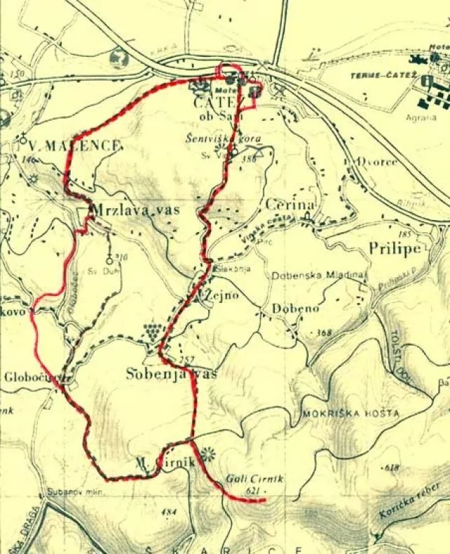
After a short rest and taking in the scenery, go back to the fork, turn left and continue along the forest path, past the first vineyards and along the gravel road to the village of Sobenja Vas. In the middle of the village, a trail sign and an arrow on a concrete retaining wall point towards the southeast, to a signpost for Veliki Cirnik Hill. Follow a well-marked forest track that will take you to the Veliki Cirnik–Mali Cirnik crossroads.
Continue along the forest path, past a hunting pen and to the Veliki Cirnik–Stojdraga fork. On the top (Veliki Cirnik, 621m), you can take a rest on the benches at the “Pri veseli Mici” bivouac, enter your arrival into the registration book and confirm it with the control stamp.
After taking a short rest, descend past a hunter’s lodge to the village of Globočice. Continue through the village of Mrzlava vas to a field and take a path through the woods and descend to the starting point in the valley. The route is marked.